Valley Hikes Overview
| Valley | Distance | Difficulty | Time | Start Point | Highlights |
|---|---|---|---|---|---|
| Rose Valley | 4–5 km | Moderate | 2–3 hrs | Göreme or Çavuşin | Pink rock, carved churches, vineyards |
| Red Valley | 3–4 km | Moderate | 1.5–2 hrs | Connects to Rose Valley | Red-tinted formations, panoramic views |
| Love Valley | 2–3 km | Easy–Moderate | 1–1.5 hrs | north of Göreme | Iconic phallic fairy chimneys |
| Pigeon Valley | 4 km | Easy | 1.5–2 hrs | Uçhisar to Göreme | Carved pigeon houses, gentle downhill |
| Ihlara Valley | 4–16 km | Easy–Moderate | 2–5 hrs | Ihlara village | River canyon, rock churches |
| Devrent (Imagination) Valley | 1–2 km | Easy | 30–45 min | Near Avanos | Animal-shaped rock formations |
| Sword Valley (Kılıçlar) | 2–3 km | Moderate | 1–1.5 hrs | Near Göreme | Fewer crowds, cave churches |
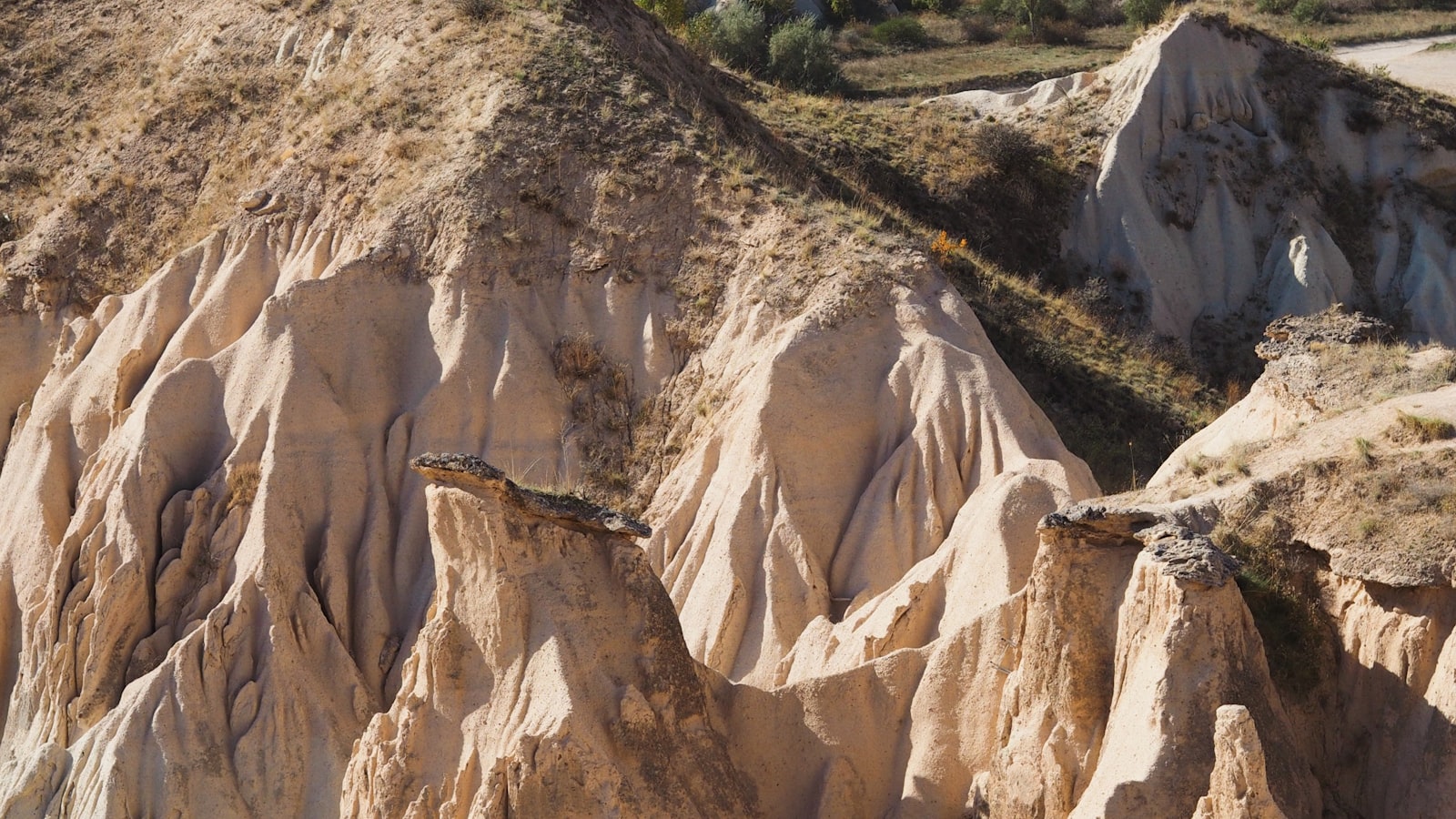
Rose & Red Valley (Top Pick)
The best hike in Cappadocia. Most hikers combine Rose and Red valleys into a single trek.
The route: Start from Göreme or Çavuşin, walk through pink-tinted rock spires, pass carved rock churches (some with fading frescoes), wind through vineyards, and emerge at the other end. The colors shift from pink to red as you transition between the two valleys.
Tips:
- Start from Çavuşin and hike toward Göreme for the best light in the afternoon
- Or start from Göreme in the early morning when the valley is empty
- Several rock churches along the way have pigment frescoes — look for open doorways
- The trail has some ups and downs — wear proper shoes (not sandals)
- Sunset from the ridge between Rose and Red valleys is spectacular
Love Valley
Famous for its tall, mushroom-shaped fairy chimneys. The name comes from their suggestive shapes. It's shorter and easier than Rose Valley, making it a good option for a morning hike.
The route: Enter from the north end of Göreme (follow signs). The trail loops through the valley floor between towering formations. Allow 1–1.5 hours for photos and walking.
Tips:
- Best light in the early morning
- Easier terrain than Rose Valley — families can manage this
- The viewpoint above the valley entrance offers a panoramic overlook
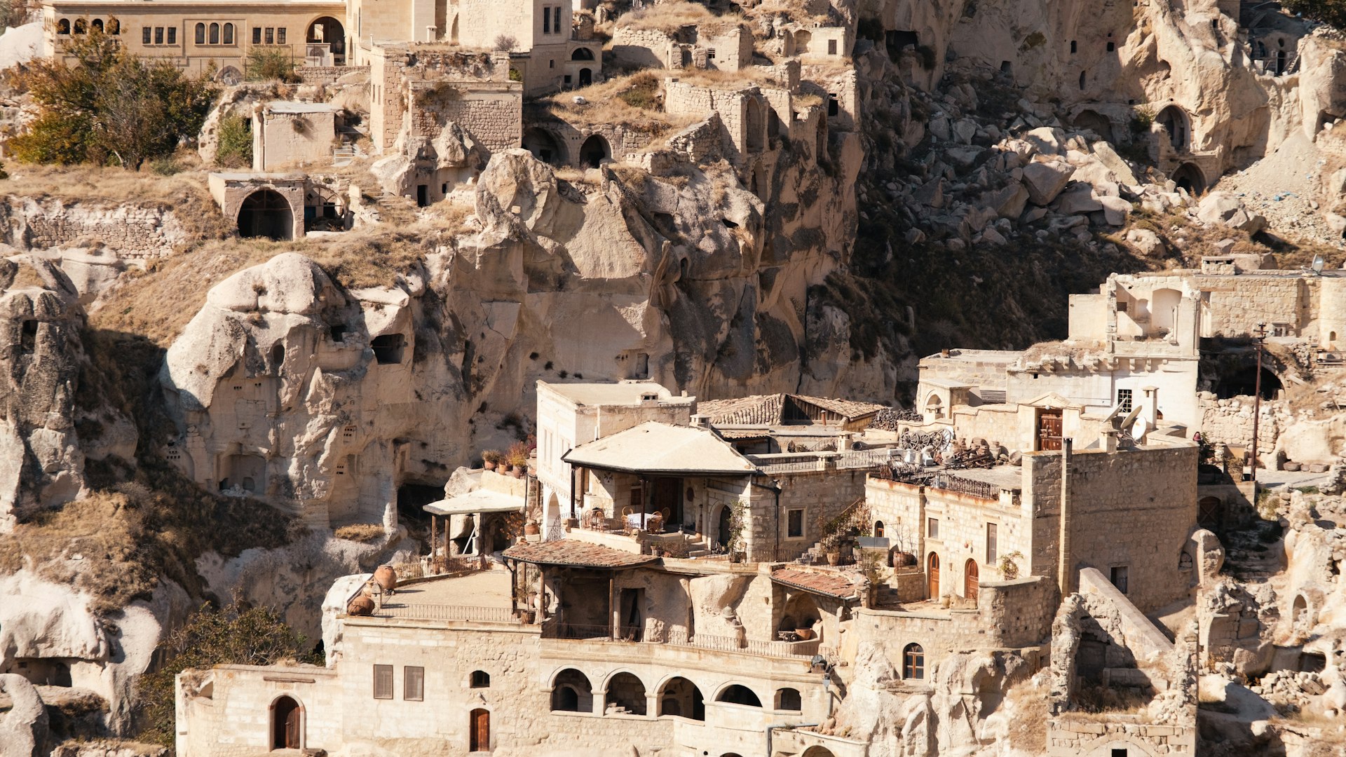
Pigeon Valley (Easiest)
A gentle, mostly downhill walk from Uçhisar to Göreme. Named for the thousands of pigeon houses carved into the cliff faces — pigeons were domesticated here for their guano (fertilizer).
The route: Start at Uçhisar Castle and walk down toward Göreme (4 km, 1.5–2 hours, mostly flat or downhill). The trail is well-marked and shaded in parts.
Tips:
- Best direction: Uçhisar → Göreme (downhill)
- Combine with a visit to Uçhisar Castle at the start
- Easy enough for all fitness levels
- Good golden-hour light for photography
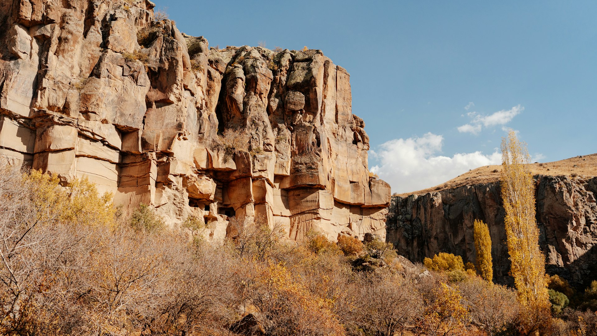
Ihlara Valley (Most Dramatic)
A 100-meter-deep river canyon, 16 km long, with rock-cut churches, riverside trails, and dramatic cliffs. It's the most impressive natural landscape in Cappadocia but requires transport (80 km south of Göreme).
The route: Most hikers walk the popular 4–5 km section between Ihlara village and Belisırma. The full valley is 16 km if you want the complete experience.
Tips:
- 400+ stone steps to descend into the canyon at the Ihlara entrance
- Riverside lunch restaurants in Belisırma (try the trout)
- Best combined with the Green Tour or a rental car day trip
- Allow a full half-day including drive time
Best Viewpoints
| Viewpoint | What You See | Best Time | How to Get There |
|---|---|---|---|
| Göreme Panoramic Viewpoint | Town + fairy chimneys + balloons | Sunrise | Walk from Göreme center (10 min) |
| Lover's Hill | Valley views + balloons | Sunrise/sunset | Walk from Göreme (15 min) |
| Uçhisar Castle | 360° panorama, highest point | Anytime | Taxi/drive + climb (ticketed) |
| Rose/Red Valley Ridge | Valley colors at golden hour | Sunset | During valley hike |
| Ortahisar Castle | Quieter alternative to Uçhisar | Afternoon | Drive/taxi to Ortahisar |
Practical Hiking Tips
- Water: Carry at least 1.5 liters per person. There are no water sources on most trails.
- Shoes: Closed-toe, sturdy walking shoes. Trails are rocky and uneven.
- Navigation: Trails are mostly marked but can be confusing. Download offline maps (Maps.me has good Cappadocia trail coverage).
- Sun: Little shade in most valleys. Wear a hat and sunscreen.
- Season: Spring (April–June) is greenest. Summer is hot (start early). Autumn is ideal. Winter trails can be muddy or snowy.