What Is the Lycian Way?
The Lycian Way (Likya Yolu) is a 540 km waymarked trail running along Turkey's Mediterranean coast from Fethiye to Antalya. It follows ancient Lycian paths, Roman roads, and mule trails through coastal forests, past ruins, over mountains, and along cliff edges.
Thru-hiking the whole thing takes about 30 days. But you can hike individual day sections for the highlights.
Best Day-Hike Sections Near Fethiye
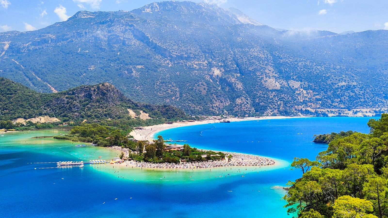
1. Ölüdeniz to Faralya (Butterfly Valley Overlook)
The must-do day hike. A trail from the back of Ölüdeniz climbs through pine forest to a stunning clifftop viewpoint over the Blue Lagoon and Butterfly Valley.
| Detail | Info |
|---|---|
| Distance | 7–8 km one way |
| Duration | 3–4 hours one way |
| Difficulty | Moderate — steep in places |
| Highlights | Aerial Blue Lagoon views, Butterfly Valley clifftop, pine forest |
| Get back | Dolmuş from Faralya, or retrace steps |
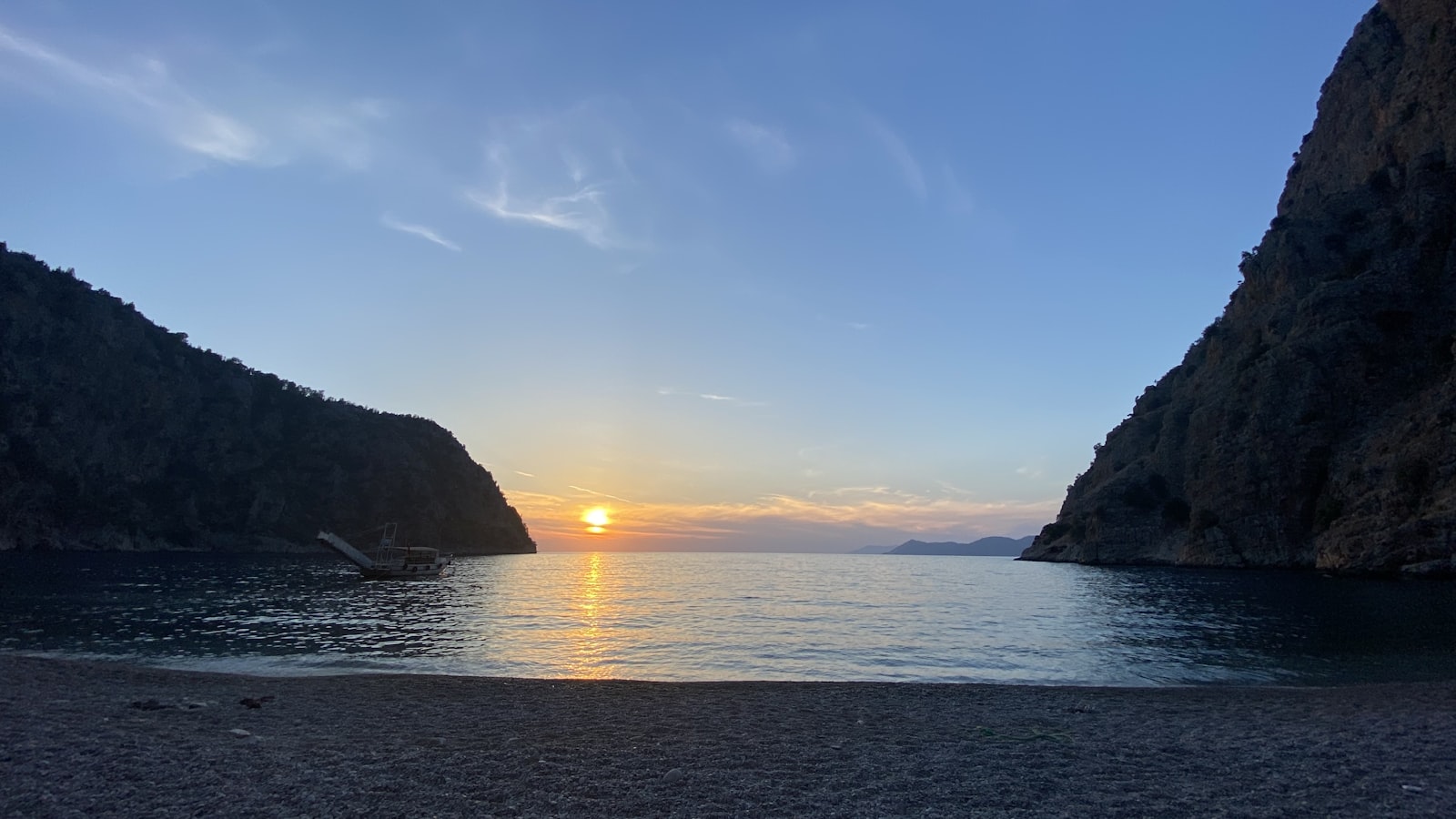
2. Faralya to Kabak Bay
A continuation down from Faralya to the hidden Kabak Beach — a remote cove accessible only by trail or boat.
| Detail | Info |
|---|---|
| Distance | 4–5 km |
| Duration | 2–3 hours |
| Difficulty | Moderate–hard (steep descent) |
| Highlights | Cliff views, remote beach, swimming |
| Get back | Dolmuş from Kabak, or boat to Ölüdeniz |
3. Kayaköy Ghost Village to Ölüdeniz
Walk through the eerily beautiful abandoned Greek village of Kayaköy (hundreds of stone houses left empty since the 1920s population exchange) and continue downhill to Ölüdeniz.
| Detail | Info |
|---|---|
| Distance | 5–6 km |
| Duration | 2–3 hours |
| Difficulty | Easy–moderate |
| Highlights | Ghost village ruins, forest, Ölüdeniz descent |
| Get back | Dolmuş from Ölüdeniz |
4. Fethiye to Kayaköy
A shorter walk from Fethiye to the ghost village. Can be combined with the Kayaköy–Ölüdeniz section for a full-day hike.
| Detail | Info |
|---|---|
| Distance | 5 km |
| Duration | 1.5–2 hours |
| Difficulty | Easy |
| Highlights | Forest walking, approach to Kayaköy |
When to Hike
| Season | Conditions | Rating |
|---|---|---|
| March–May | Wildflowers, comfortable temperatures (15–25°C) | ✅ Best |
| Jun | Warm, longer days, starting to heat up | ✅ Good |
| Jul–Aug | Very hot (30–35°C+), little shade on exposed sections | ⚠️ Early morning only |
| Sep–Nov | Warm, excellent visibility, comfortable | ✅ Excellent |
| Dec–Feb | Cool, possible rain, short days | ⚠️ Depends on conditions |
Practical Tips
- Navigation: The trail is marked with red-and-white blazes. Carry a downloaded offline map (Maps.me or Avenza Maps).
- Water: Carry at least 2 liters per person. Water sources are limited on coastal sections.
- Shoes: Sturdy hiking shoes (not sneakers, not sandals). The terrain is rocky and uneven.
- Sun protection: Hat, sunscreen, sunglasses — essential on exposed coastal sections.
- Start early: Especially in summer — shade disappears after mid-morning.